Pilot Water Resource Information System Strengthens Water Security in Kenya’s ASALs
Photo: @Imani Manyara
The pilot project Water Resources Information System (WRIS) provides an information system tailored for Kenya’s arid and semi-arid lands (ASALs), enabling county governments and national agencies to better plan and manage water resources in the face of worsening climate pressures.
Developed by the UNEP-DHI Centre in partnership with county and national stakeholders and Rural Focus Ltd. The WRIS was piloted in Turkana and Isiolo counties between November 2023 and December 2024. By closing long-standing gaps in water-data accessibility, the WRIS strengthens coordination among county governments, national agencies, and development partners, ultimately advancing water security.
Key Outcomes of the Pilot
Development of a fully operational, web-based WRIS tailored to ASAL needs
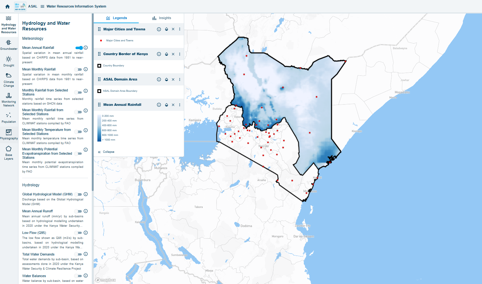
The WRIS is an online, map‑based platform that brings together earth‑observation layers, groundwater and surface‑water point data, climate indices, time‑series charts, and interactive analytics.
Deployment of the Knowledge App
The app is an open digital library holding around 250 key documents (policies, technical studies, county development plans, etc.), each fully searchable and downloadable
Strong stakeholder participation, with over 100 representatives engaged in consultations and workshops
The WRIS is a map-based system which makes it easy and intuitive for the user to access data.
Data visualization
The system enables visualization of key water resources information and indicators at national, county, and sub-basin levels. The information is presently focused on the following eight themes
Hydrology and Water Resources
Groundwater (including information on groundwater aquifers and boreholes)
More than 100 stakeholders from county departments in Turkana, Isiolo and Nairobi, including from the Water Resource Authority, National Drought Management Authority, and NGOs were trained to use the WRIS. Ongoing feedback from stakeholders highlights the value of the WRIS and the Knowledge App, recognizing them as effective tools for visualizing upstream–downstream water dynamics and facilitating the reliable exchange of data across institutions.
The pilot’s success marks a critical step toward scaling the WRIS to more counties, enhancing Kenya’s capacity to manage water in a changing climate.